1/76


التفاصيلالمراجعاتالنُّسَخالمعلومات
1/76
وصف لـ NextGIS Mobile
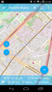
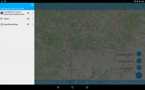
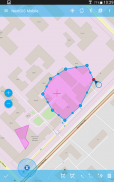
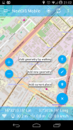
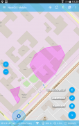
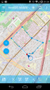
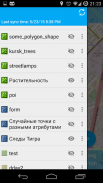
NextGIS Mobile is a geographic information system for your mobile device that can:
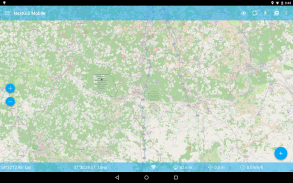
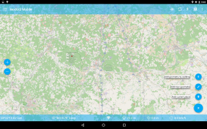
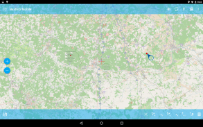
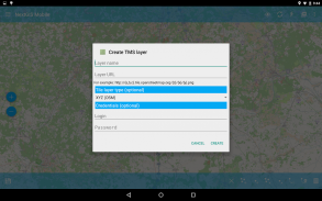
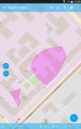
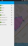
- show multi-layer map (layers can come from online and offline sources)
- change visibility and layers order
- navigate the map (panning, zoom in, zoom out)
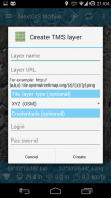
- edit vector data (both geometries and attributes) online and offline
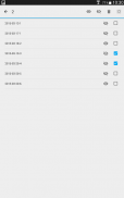
- record tracks
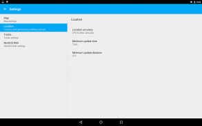
- show coordinates, speed, elevation etc.
NextGIS المحمول هو نظام المعلومات الجغرافية لجهازك المحمول التي يمكن أن:
- عرض خريطة متعددة الطبقات (طبقات يمكن أن تأتي من الانترنت ومصادر متواجد حاليا)
- تغيير الرؤية وطبقات ترتيب
- تنقل الخريطة (بالغسل، تكبير، تصغير)
- تحرير البيانات ناقلات (سواء هندستها والصفات) على الانترنت وغير متصل
- مسارات سجل
- إحداثيات العرض والسرعة والارتفاع الخ
NextGIS Mobile - إصدار 2.6.52
(29-01-2024)ما الجديدFixed combobox element visibility in forms

تطبيق جيد نوصي بهلقد اجتاز هذا التطبيق اختبار الأمان من الفيروسات، البرمجيات الخبيثة أو أي هجمات خبيثة أخرى وهو لا يحتوي أي تهديد.
NextGIS Mobile - معلومات APK
نُسخة APK: 2.6.52الحزمة: com.nextgis.mobileالاسم: NextGIS Mobileالحجم: 19.5 MBالتنزيلات: 51الإصدار : 2.6.52تاريخ الإصدار: 2024-03-19 08:19:44الشاشة: SMALLيدعم CPU نوع: x86, x86-64, armeabi-v7a, arm64-v8a
عنوان الحزمة: com.nextgis.mobileتوقيع SHA1: 98:7C:B6:CF:A5:A2:14:1C:D1:0F:8E:13:AD:2A:50:BA:9B:D8:8F:2Eالمطور (CN): Dmitry Baryshnikovالمنظمة (O): NextGISمحلي (L): Moscowالبلد (C): RUولاية/مدينة (ST): Russia
تطبيقات من الفئة نفسها
قد يعجبك أيضًا...

English


